
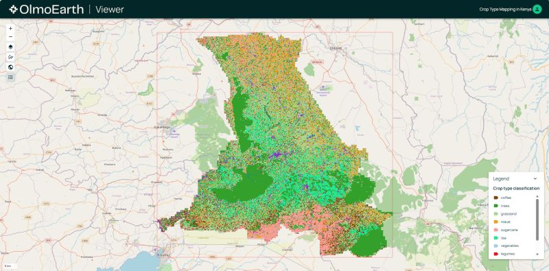
OLMoEarth – open-source (training data, code, models) Earth Observation V1.1 released. OlmoEarth is an Earth-observation AI system built by Ai2 (the Allen Institute for AI), the earth image counterpart to Ai2’s OLMo open language models.
There is a family of foundation models trained on roughly 10 terabytes of global satellite and sensor data, designed to turn raw Earth-observation signals into useful analysis. Such as land cover, crop type, deforestation, vegetation etc. The models come in four sizes, from about 1.4 million parameters up to around 300 million, all sharing one vision-transformer architecture. These are small and cheap to run.
There is also an online platform wrapped around the models. A Studio for building and fine-tuning your own models (including a no-code, guided interface), a Viewer for exploring AI-generated maps in the browser, a workflow engine, and an API. The aim is to let governments, NGOs and local communities use the technology without needing deep AI expertise.
Early real-world uses include updating global mangrove maps, detecting Amazon deforestation, mapping crop health in Kenya, and predicting wildfire risk.
What sets it apart is the openness. Ai2 publishes the model weights, the training code, the pretraining dataset, the evaluation stack and the technical report, so the system can be inspected, rebuilt, fine-tuned and self-hosted rather than only accessed through a vendor. Its license prohibits use for extraction industries.
Link https://allenai.org/olmoearth
hashtag#geoscience hashtag#earthscience hashtag#climate hashtag#climatechange hashtag#earthobservation hashtag#EO hashtag#languagemodel hashtag#visiontransformer hashtag#datasovereignty hashtag#artificialintelligence hashtag#environment
 A Geodyssey - Geoscience Text Analytics and Enterprise Search Research
Leave a comment