
Martian Geology: Scalable AI unlocks global image search and mapping. Exciting opportunities to combine geology, AI & planetary exploration.
Paper from Annex (2025) at the SETI Institute. Link in the comments.
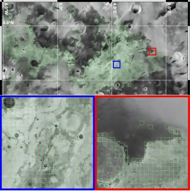
“The Mars Reconnaissance Orbiter (MRO) Context Camera (CTX) instrument has over the past nearly-two decades captured essentially the entirety of the surface of Mars at approximately 6 meters per pixel, resulting in a global mosaic produced and made available to the community by Dickson et al. in early 2023, updating a previously published “beta” mosaic product. This mosaic enables examination of nearly the entire surface of Mars for geologic features of interest to scientists by solving the enormously technical challenges of georegistration to produce a “harmonized” and analysis ready dataset.
However, the massive size of this dataset, approximately 5.7e12 pixels presents a new challenge to scientists interested in conducting global surveys as there is simply too much data for one individual to survey in a reasonable amount of time (over 100k CTX images were used to make the mosaic, and the mosaic has ~4000 4°x4° tiles). Below, we describe efforts towards using image retrieval methods based on foundational machine learning models that enable multiple methods for rapid search and discovery from this dataset and directions for future efforts and collaborations.”

Leave a comment