
Many organisations are using Natural Language Processing (NLP) and Machine Vision to extract and classify images from their documents (such as PDF, PPT, Word, Literature etc.).
Hoover et al (2023) published an interesting paper on how they achieved this, “Enhancing knowledge discovery from unstructured data using a deep learning approach to support subsurface modeling predictions”
Their abstract states:
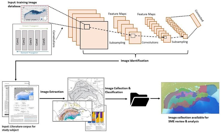
“Subsurface interpretations and models rely on knowledge from subject matter experts who utilize unstructured information from images, maps, cross sections, and other products to provide context to measured data (e. g., cores, well logs, seismic surveys). To enhance such knowledge discovery, we advanced the National Energy Technology Laboratory’s (NETL) Subsurface Trend Analysis (STA) workflow with an artificial intelligence (AI) deep learning approach for image embedding. NETL’s STA method offers a validated science-based approach of combining geologic systems knowledge, statistical modeling, and datasets to improve predictions of subsurface properties. The STA image embedding tool quickly extracts images from unstructured knowledge products like publications, maps, websites, and presentations; categorically labels the images; and creates a repository for geologic domain postulation. Via a case study on geographic and subsurface literature of the Gulf of Mexico (GOM), results show the STA image embedding tool extracts images and correctly labels them with ~90 to ~95% accuracy.”
Paper here: https://www.frontiersin.org/articles/10.3389/fdata.2023.1227189/full

Leave a comment