
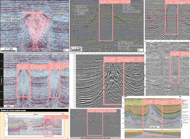
As well as classifying images within documents it is also possible to detect geological features on them. I built a deep learning model to detect salt diapirs and applied it to unseen data as shown in the montage. This can be useful to enhance search & discovery, especially if there is little/no text on or around the image.
Salt structures are of significant interest for hydrocarbon exploration and also as potential storage sites for hydrogen as we transition to low carbon energy technologies.
The public data I used to label and train the model was generally of poor resolution, images found in reports and PowerPoint presentations. Many images were also ‘messy’ often annotated in some way with lines, text and colouring – as is typical inside reports.
Accuracy will never be of the quality of using raw SEGY data of course, but the intended purpose is not for specific geometric accuracy, rather to simply label the fact the image contains a geological feature of interest (e.g. salt diapir). Early results seem very promising. Other features could include geobodies such as reefs/carbonate mounds, growth structures, onlap/offlap etc.
At this resolution on images found in reports and PPT slides, it may (or may not) be possible to differentiate between salt diapirs and mud diapirs. Gas chimneys may (or may not) produce similar patterns as far as the deep learning model is concerned. Both present further areas for testing and experimentation!
#artificialintelligence #geosciences #machinelearning #subsurface #geophysics #geology #digitalgeoscience #seismic

Leave a comment