
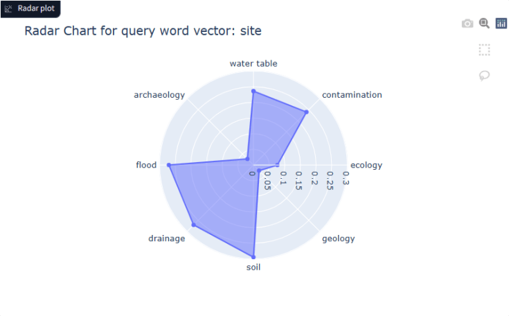
Radar plots using word vectors can be useful to compare what ‘the text’ of many reports might be saying (perhaps too much to read) to quantitative data on aspects such as risk or uncertainty.
It may highlight mismatches or contradictions requiring further investigation.
The illustrative example is driven from a corpus of millions of words from geoscience articles, it may relate to a construction site of some sort, deposit, prospect – whatever the user decides, the dimensions are word vectors (embeddings) again, can be user defined or semi-automated based on key risks.
#geosciences #naturallanguageprocessing #analytics #miningexploration #oilandgasexploration #geothermalenergy #geotechnical #geohazards #hydrogeology #artificialintelligence

Leave a comment